

The Complexity of the U.S.-Canada Border
The U.S.-Canada border, often described by President Trump as an “artificial line,” is a subject of considerable debate and misconception. To understand the validity of this claim, it is essential to delve into the historical and geographical context that shaped this boundary.
Historical Context
The U.S.-Canada border was not arbitrarily drawn but was shaped by a series of treaties that spanned from 1783 to 1925. The first significant treaty was the Treaty of Paris in 1783, which ended the American Revolution. This treaty recognized American independence and established the Mississippi River as the western border of the new United States. Over the years, the U.S. continued to expand, and additional treaties were necessary to delineate the boundary with Canada.
One of the most pivotal agreements was the Convention of 1818, which officially established the 49th parallel as the border between the U.S. and Canada from the Lake of the Woods to the Rocky Mountains. This treaty marked a significant step in defining the modern boundary between the two nations. Further treaties, such as the Oregon Treaty of 1846, continued to refine the border, particularly in the Pacific Northwest.
Geographical and Political Implications
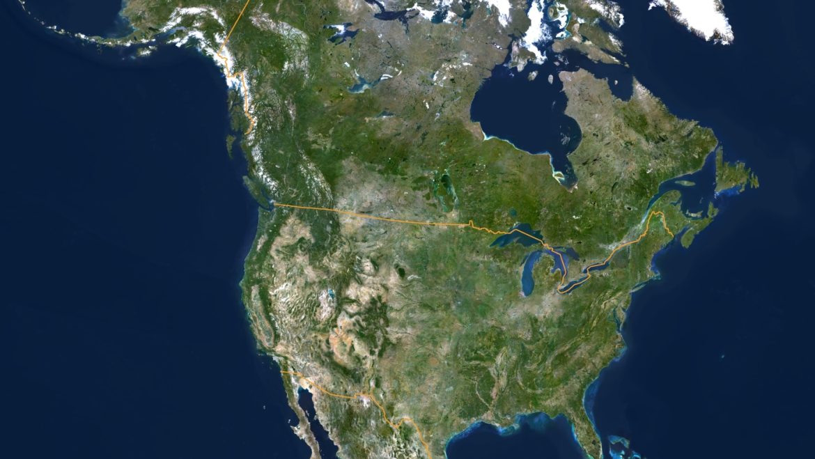
The U.S.-Canada border is not just a line on a map; it is a complex web of geographical features and political agreements. The border stretches nearly 9,000 kilometers, making it the longest international boundary between two countries. It traverses diverse landscapes, including forests, mountains, and vast expanses of water, such as the Great Lakes and the Atlantic and Pacific Oceans.
The border’s legitimacy is not diminished by its artificial origins. In fact, the process of drawing and maintaining this boundary has involved centuries of diplomatic negotiations, treaties, and, in some cases, military skirmishes. These historical events have shaped the border into a tangible and recognized division between two sovereign nations.
The Modern Perspective
In modern times, the U.S.-Canada border is often referred to as the world’s longest undeclared border, a testament to the peaceful coexistence and mutual respect between the two countries. The border is not just a geographical line but a symbol of the diplomatic and political agreements that have maintained peace and stability in North America.
The notion that the border is “artificial” oversimplifies the intricate history and the ongoing significance of this boundary. It is a product of centuries of negotiations, treaties, and mutual agreements that have ensured stability and cooperation between the two nations.
The Impact of Trump’s Statements
President Trump’s repeated characterization of the U.S.-Canada border as an “artificial line” has sparked debate and criticism. Critics argue that this description undermines the historical and diplomatic efforts that have shaped the border. Experts contend that while the border is indeed man-made, it is no less legitimate or significant.
The Border’s Significance
The U.S.-Canada border is more than just a line on a map; it represents a complex history of diplomacy, conflict resolution, and mutual respect. It is a testament to the enduring relationship between the United States and Canada, two nations that have maintained a peaceful and cooperative border for centuries.
Conclusion: The Border’s Enduring Legacy
In conclusion, the U.S.-Canada border is far from an “artificial line.” It is a product of centuries of diplomatic efforts, treaties, and mutual agreements that have shaped it into a tangible and recognized division between two sovereign nations. The border’s significance lies not in its artificial origins but in its enduring legacy of peace and stability. To dismiss it as merely an “artificial line” is to overlook the complex history and ongoing significance of this boundary.